Gale vs Storm: Using the Beaufort Scale to Understand UK Wind Reports
Gale vs Storm: Using the Beaufort Scale to Understand UK Wind Reports
A forecast mentions gale force eight, then a friend says a storm is coming. Are they talking about the same thing? Not quite. On the Beaufort scale, a gale and a storm are separated by a whole category — and the difference matters whether you are planning a ferry crossing, a hill walk, or just whether to cycle to work. It also matters when you hear a named storm has been announced, because the name is about expected impacts, not a guarantee that every street will reach storm force 10. Here is how to read the terms properly.
What the Beaufort scale actually measures
The Beaufort scale was created for sailors, using observable effects on the sea. Today it is tied to wind speed, usually measured as a mean over ten minutes at ten metres above open ground. That mean is important: it smooths out gusts. A forecast might say force 8, but a gust could be much higher. The scale runs from 0 (calm) to 12 (hurricane force), and UK forecasts often use knots because of maritime tradition.
On land, the same wind speed feels different depending on exposure. A force 7 on a sheltered high street is unpleasant; on an exposed coastal headland it can knock you off balance. This is why two people can listen to the same forecast and have completely different experiences. A weather station at an airport may record a mean of 30 knots, while a nearby hilltop or pier records 45 knots. Shelter, altitude, and local topography all change the real-world effect.
Gale vs storm: the numbers
In UK wind reports, “gale” normally means force 8. “Storm” means force 10. Between them sits force 9, “severe gale”. Here is the useful part of the scale:
- Force 6 – strong breeze: 22–27 knots (25–31 mph). Large branches move, umbrellas are a losing battle.
- Force 7 – near gale: 28–33 knots (32–38 mph). Whole trees in motion; walking into it is hard work.
- Force 8 – gale: 34–40 knots (39–46 mph). Twigs break off, progress on foot is difficult.
- Force 9 – severe gale: 41–47 knots (47–54 mph). Slight structural damage possible; tiles and branches come down.
- Force 10 – storm: 48–55 knots (55–63 mph). Trees uprooted, considerable damage to buildings.
- Force 11 – violent storm: 56–63 knots (64–72 mph). Widespread damage; rarely used on land.
- Force 12 – hurricane force: 64 knots and above (73 mph+). Exceptional in the UK, but possible in exposed coastal areas.
So a gale is two full steps below a storm. That gap is not academic. A force 8 can close roads and stop ferries; a force 10 can bring down trees and damage roofs. Force 9, the severe gale, is often the middle ground where travel disruption becomes widespread but the language in everyday conversation still lags behind. If a forecast says “severe gale”, treat it as significantly more serious than a standard gale warning.
Why UK reports say “gale” when it feels like a storm
Everyday language blurs the line. People call any deep low-pressure system a “storm”, especially if it brings heavy rain, thunder, or snow. In a shipping forecast or a Met Office wind warning, the words have specific meanings. A “storm” is force 10. A “gale” is force 8. A “severe gale” is force 9.
Named storms add another layer. The UK naming system is based on the potential for significant impacts, not on whether every area reaches storm force 10. So a named storm might bring a spell of force 8 or 9 winds with damaging gusts, while the strongest winds stay offshore. If you only look at the name, you can misjudge the local wind. A named storm can also be remembered for rain and flooding rather than wind strength alone.
Also watch for “storm force” in warnings. It is not a casual phrase; it points to force 10 or higher. “Gale force” points to force 8 or 9, depending on the wording. The difference between “gale force 8” and “storm force 10” is the difference between a difficult day and a dangerous one for many activities.
In official forecasts, “storm” is not a synonym for “bad weather”. It is a defined category on the Beaufort scale, and it sits two steps above a gale.
How to read a wind report without getting caught out
Wind reports are compact, but they carry a lot. Use this checklist:
- Find the speed and unit. UK shipping forecasts use knots. Land forecasts often use mph. One knot is about 1.15 mph, so 40 knots is roughly 46 mph.
- Check whether it is mean or gust. Beaufort is based on mean wind. Gusts can be 40–50% higher, sometimes more in squalls. A force 6 with 50 mph gusts can feel like a gale.
- Note the area and exposure. Coastal headlands, hills, and bridge decks are windier than inland towns. A forecast for “the north coast” may not match your sheltered valley.
- Look at direction and timing. A wind that veers or backs can change which routes are exposed. The duration matters too: six hours of force 8 is very different from a brief squall.
- Read the whole warning. “Gusts of 60 mph” is not the same as “sustained 60 mph”. The first is a gust risk; the second is storm force by mean speed.
If you are heading out on the water, the shipping forecast and inshore waters forecast give the detail. If you are staying on land, the Met Office warnings and local mountain forecasts often translate the numbers into likely impacts, such as travel delays, power cuts, or flying debris.
Gusts, squalls, and why the mean wind hides the worst
Beaufort is based on a ten-minute mean, but damage is often done by gusts. A gust is a short burst of higher wind, and in convective conditions or squally showers it can exceed the mean by 50% or more. That is why a forecast of force 7 can still bring down a weak branch or make a high-sided vehicle unstable.
Squalls are particularly deceptive. They can arrive with little warning, especially along coasts and near showers. A sailor may see a dark line on the water and have only minutes to reduce sail. On land, the same squall can slam a car door, snap a tent pole, or push a cyclist into traffic. When you read a forecast, look for phrases such as “gusty”, “squally”, or “gusts of 50–60 mph” alongside the Beaufort number.
Topography matters too. Wind can funnel through valleys, accelerate over cols and ridges, and create localised jets around buildings. A city centre may feel calm while a nearby exposed bridge is closed to high-sided vehicles. This is why the same force number can produce very different conditions within a few miles.
What gale and storm force mean in practice
Translating Beaufort numbers into real-life decisions helps you plan. The following examples are broad guides, not hard rules, but they show how quickly the risk escalates:
- Ferries and bridges: Force 6 or 7 can cause delays and cancellations on exposed crossings. Force 8 often triggers restrictions on bridges and some ferry routes. Force 9 and 10 can close bridges to all high-sided vehicles and suspend sailings.
- Hill walking: Force 6 is tiring; force 7 makes balance and navigation harder. Force 8 or 9 on an exposed ridge can be dangerous even for experienced walkers. Force 10 or above is a clear signal to change plans.
- Cycling: Force 6 crosswinds are unpleasant; force 7 or 8 can make a bike hard to control, especially on open roads. Force 9 or 10 is not a day to ride an exposed route.
- Driving: Force 6 or 7 can affect caravans and lorries on exposed stretches. Force 8 or 9 brings a risk of debris and sudden side winds at bridge exits. Force 10 can bring down trees and block routes.
- At home: Force 8 may loosen fence panels and bins. Force 9 can lift tiles and bring down branches. Force 10 can uproot trees and cause structural damage.
In short, a gale is a day to adjust plans. A storm is a day to avoid exposed places altogether if you can. The two categories are not interchangeable, and the Beaufort scale gives you a precise way to tell them apart.
A quick memory aid
If you remember only one thing, remember this: gale = force 8, severe gale = force 9, storm = force 10. A named storm may not reach force 10 everywhere, and a “gale warning” is not the same as a “storm warning”. Always check the mean speed, the gusts, and the exposure of where you are going. That way, when someone says a storm is coming, you can ask the useful follow-up question: “Do you mean force 8, or force 10?”
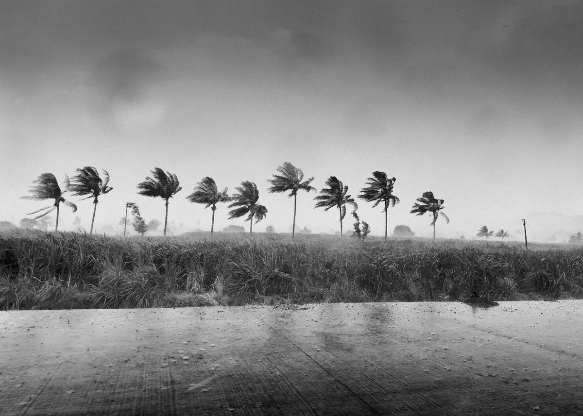
Photo: Shubham Dhage / Pexels

You Might Also Like
A practical guide to building a personal severe weather watch routine: checking forecasts, setting useful alerts, and writing a simple trigger plan before the storm arrives.
UK wind records are messier than they look. This explainer covers what the data can and cannot tell us about wind trends, and why weather is not climate.